The map is back
15.12.2022
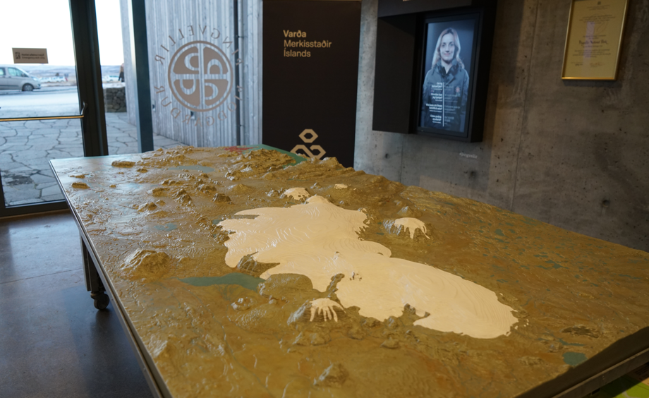
The relief map of Þingvellir inside the Visitor centre
The map is back in the park´s Visitor centre after getting some makover.
Þingvellir Þjóðgarður
The relief map stationed inside the park´s Visitor centre during winter is back from repair. It is send regularly to it´s maker Sigurður Halldórsson at Módelsmiði ehf to get a light touch and keep it intact. The map shows Þingvellir nearest area and stretches north of Langjökull.
The map is used a lot both by the park´s staff and guides with groups. It is great to show Þingvellir nearest area, routes that were used in the past to get to Alþingi, show Þingvallavatn catchment area and to explain the geology of Þingvellir.