Silfra
Silfra is a fissure in northern lake Þingvallavatn and is one of the 100 fissures that have formed in the circa 5 kilometer-wide stretch between the edges of the North American and the Hreppafleki (Hreppar microplate) tectonic plates. It is a popular diving site and draws thousands of people every year, all year round. Its name, which translates to silver, derives from the clarity of the water that flows through it. It is one of many places where groundwater streams to the surface after traveling through the lava fields for some 30 years from Langjökull glacier.
The northernmost part of the fissure cuts into the lava fields next to a hill called Silfruhóll. It is at most 10 meters wide and reaches a depth of 60 meters. The southern end of it collects sediment and disappears into the depths of the lake. It is not known entirely when it was formed, but according to records of the speed of the continental drift, a 10-meter-wide fissure would take at least 1500 years to form, given a drift of 5 millimeters per year.
Two common misunderstandings about Silfra exist. The most widespread one is that it is the rift of the tectonic plates. It certainly is a part of it, but the total distance between the tectonic plates is roughly 5 kilometers, and Silfra lies in a small part within this space. The second misunderstanding is that Silfra is recently formed, with the year 1789 often mentioned. Geological records show that it must in fact have existed for more than a millennium, if not longer, and historical records make mention of its existence prior to that year.
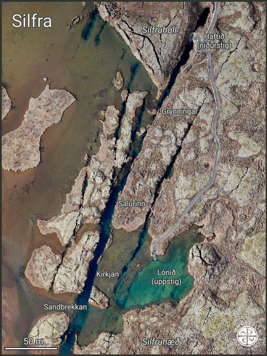
Since diving operations started in Silfra, many placenames have been added to her surroundings.
Þjóðgarðurinn á Þingvöllum
History
Few records exist of Silfra prior to the 20th century. The earliest account of it can be traced back to 1863, where the priest Einar Einarsen describes that prior to the earthquakes of 1789, Silfra was a common fishing site, but no fish was caught after said earthquakes. The fissure is later mentioned throughout the 20th century in various accounts where it is said that it was formerly a river, but following the aforementioned earthquakes, water levels covered the spring, and the current became less noticeable.
In the early 21st century, the fissure became a popular diving location, and tours were operated from there. Entry and exit platforms were built, and a trail was made to ease the divers’ trip between the fissure and the parking lot.
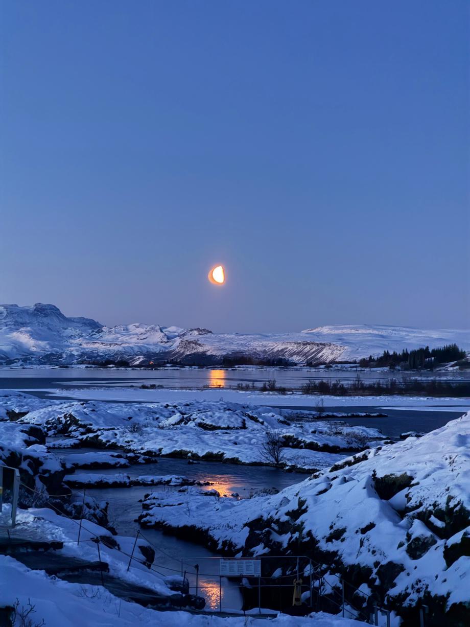
Silfra often takes on a mystic appearance at night, likely impressing many people for centuries.
Pauline LaFontaine
Geology
The fissure runs parallel to the faultlines of the tectonic plates and other fissures that have formed in the rift valley. It most likely widens at a similar rate to other fissures in the area, between 1-5 millimeters per year. The spring that feeds into it is considered one of the most powerful springs in Þingvallavatn and has been described as similar to watching a geyser erupt when it was above the water level. It´s layered sides are made up of the several lava flows that formed the area 9.000 years ago.
The clarity of the water in it, same as 90% of the water in lake Þingvallavatn, is the result of the long filtration process that starts from the Langjökull glacier and ends up in the lake. The water melts from the glacier, seeps into the porous lava fields, and gets filtered as it traverses underground for 30 years. When it emerges, it is so clear that the prime visibility in the water is approximately 100 meters.
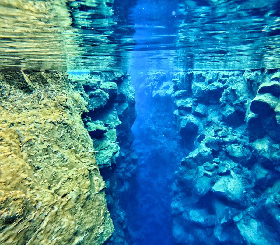
Silfra can reach a width of up to 10 meters, and a depth of 60 meters.
Pauline LaFontaine