Teconic movements
Þingvellir is connected to volcanic and fissure belt that runs across Iceland called the Mid-Atlantic ridge. The ridge extends north from the Arctic ocean and south along the entire Atlantic.
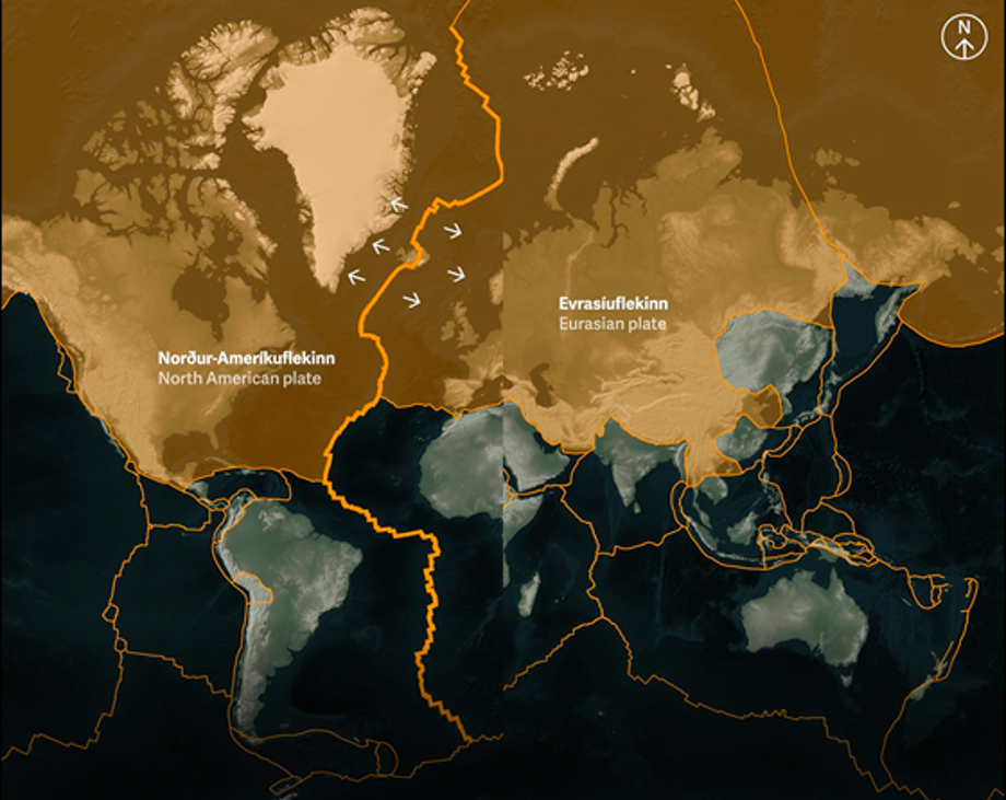
The Mid Atlantic ridge runs through Iceland and tectonic plates are moving in opposite direction.
Thingvellir national park / gagarin
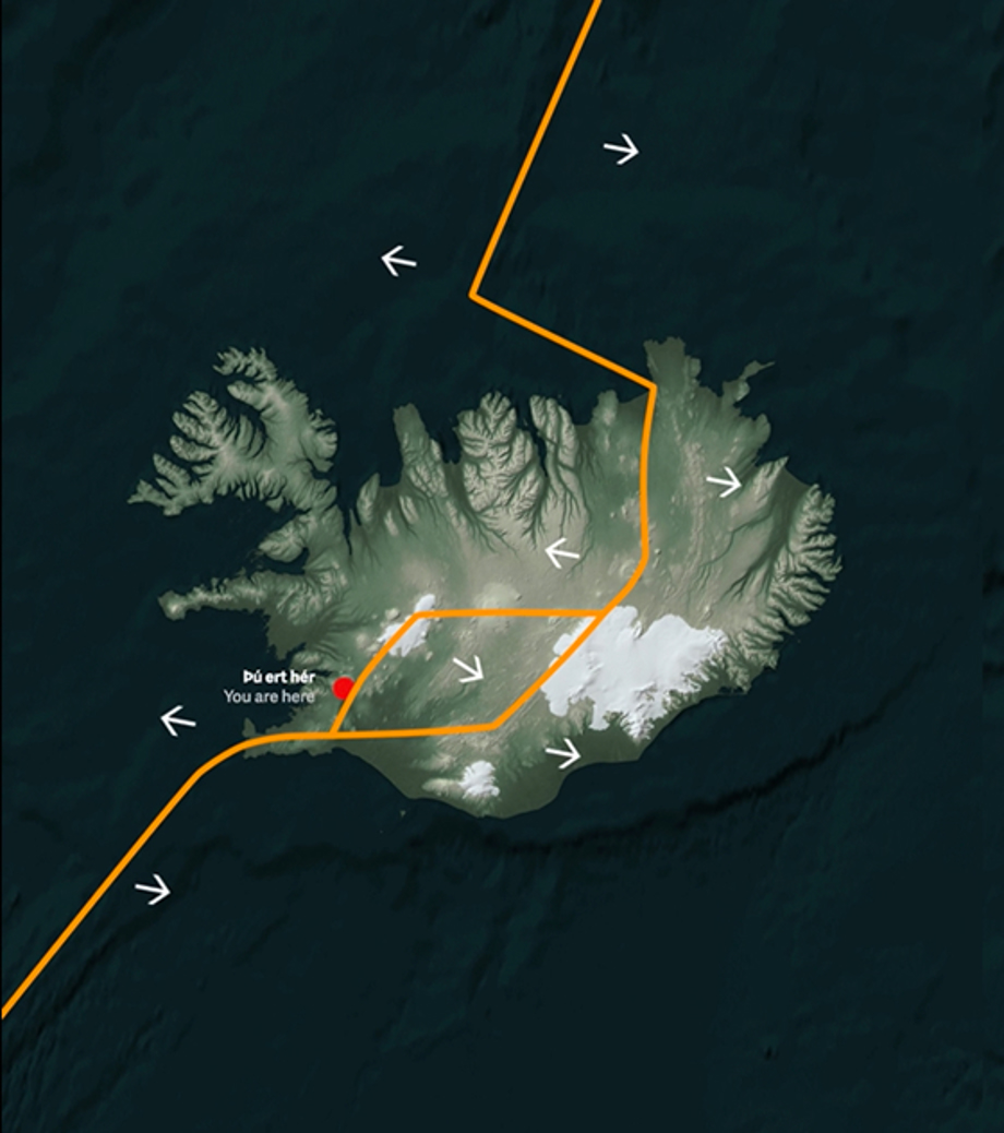
In the summer of 2000, two severe earthquakes occurred in South Iceland. Though their source lay 40-50 kilometres southeast of Þingvellir, stones fell from the ravine walls and water splashed up from the rifts. The water in the Flosagjá rift, normally crystal clear, became so murky that you couldn't see the coins lying on the bottom. The earthquakes were a result of movement of the Eurasian and North-American plate boundaries that run through Iceland. In the south, the plates inch past each other, but at Þingvellir, they break apart and the land between subsides. Away from the plate boundaries the activity is fairly constant, about two centimetres a year, but, in the rift zones themselves, tensional stress accumulates during a long period and is then released in a burst of activity when fracture boundaries are reached. The most recent burst of activity swept over Þingvellir in spring 1789.
There are three tectonic plates at play in Iceland. The big two area the North American and Eurasian. Then there is one micro-tectonic plate named Hreppafleki.
Thingvellir national park / Gagarin
Iceland owes its existence to a mantle plume that produces twice as much volcanic matter as the Mid-Atlantic ridge. The mantle plume is located east of the ridge channel, but the eruptive belt tends to follow the plume, and it's there that volcanic activity is greatest.
The earthquake zone is formed where the eruptive belt is shunted. In the eruptive belt, a new earth crust is formed that accumulates at the fault edges and gradually drifts away. The oldest rocks in the country are thus found a long way from eruptive belt, in the east and west of the country. Þingvellir is in a seven-kilometre wide graben that lies between the Almannagjá and Heiðargjá faults. It's covered with 10,000 year-old lava that originated in a crater south of mount Hrafnabjörg.
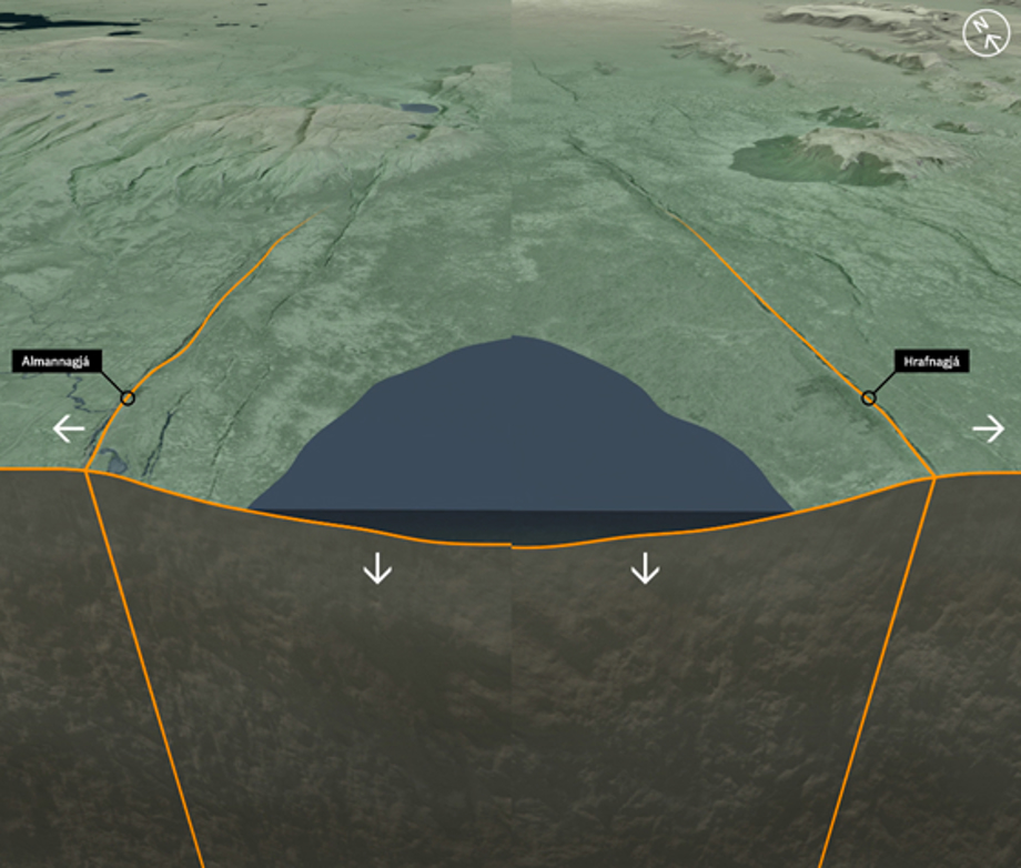
This images shows how land inbetween the faults of Almannagjá and Hrafnagjá is subsiding.
Thingvellir national park / Gagarín
During the time since the lava flowed, the land subsidence has been about 40 metres and the spreading or rifting about 70 metres. The rift valley is part of an active volcanic and fissure region that extends north from just outside the Reykjanes area to the Langjökull glacier. The outer boundaries of this are the Súlnaberg rock face in mount Botnssúlur and, in the east, mounts Lyngdalsheiði and Laugarvatnsfjall.
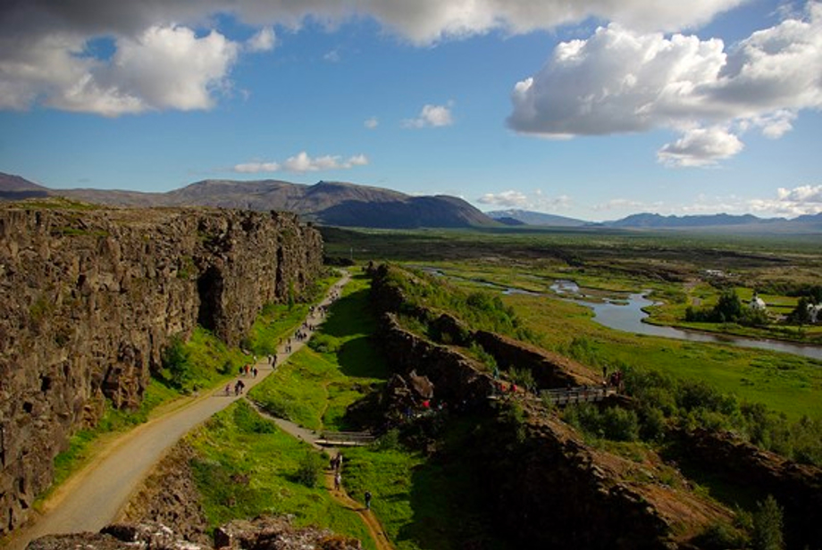
Almannagjá seen to the north
Þingvellir National Park
The landscape at Þingvellir is now quiet different to that at the time when Grímur geitskór chose the site for the general assembly. In the Sturlunga Saga it is said that the river Öxará had been diverted into Almannagjá and onto Þingvellir. The river Öxará then changed the appearance of the site through sedimentation, and land subsidence caused encroachment of water up to the assembly site. We can assume that the subsidence amounts to almost four metres from when the Alþing was established in 930.
On this interactive website you can learn more about the tectonic movements.